Vacation 2011 R
Yosemite National Park - California
26 July - 28 July 2011
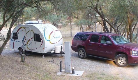
We arrived at the Coarsgold KOA at 2:00 PM on Tuesday checked-in and set up in the South side of the park.
This is the less developed part of this KOA. The roads are sandy/dusty.
The KOA people suggested driving into Yosemite and up to Glacier Point today, after 5 PM as it would be less crowded then.
We took them up on the suggestion and entered Yosemite from the South side.
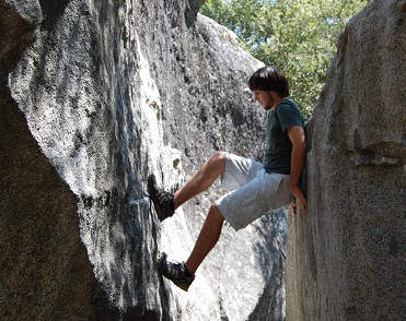
We stopped at the Wawona visitor center and got some useful information on boldering (climbing big rocks) in Yosemite Valley.
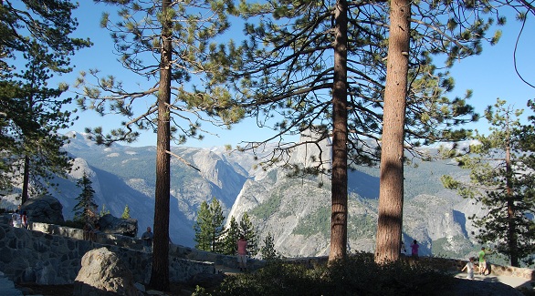
We headed on to Glacier Point, which is actually the top of the southern edge of Yosemite Valley
and which offers a great overlook for most of the middle of the Park.
The first big outlook was at Washburn Point where we got a good look at Vernal Falls.
I noted that conversations of many of the others used a wide variety of European languages.
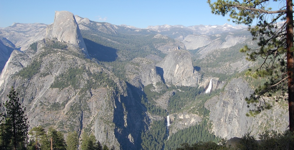
Vernal Falls with Half Dome at the upper left.
Glacier Point offers a great view of Half Dome and the various peaks in the middle of the park.
One can also look down into the valley and with a good lens see the buildings and roads over 1,000 feet below.
The benchmark mounted at the overlook notes the elevation to be 7200 ft. above sea level.
 -
-  -
-  -
- 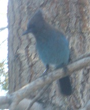
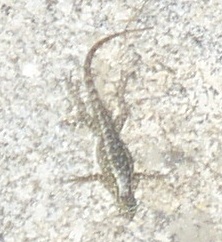
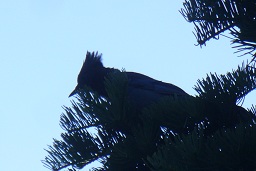
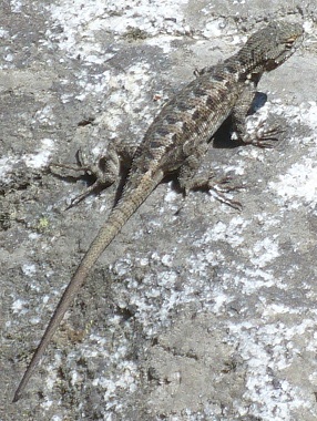
Ground Squirrel - - Lizard - - Jay
all on Glacier Point
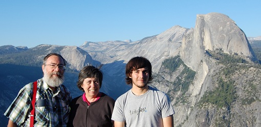
Us with Half Dome as a backdrop.
 -
- 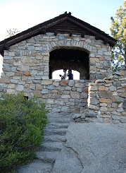

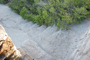
Stairs in living rock - - Geology hut - - USGS Benchmark at rim of valley.
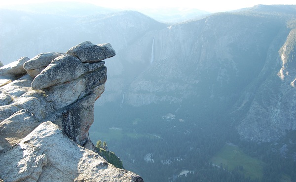
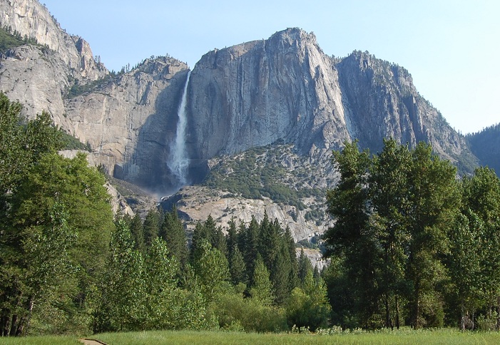
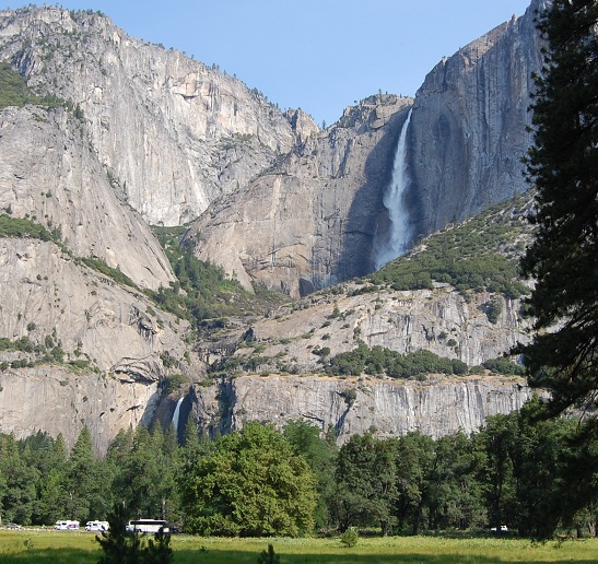
Yosemite Falls across the Valley.
As the sun set we beat a hasty retreat some 23 miles back to our camp as darkness fell.
We did a very quick and incomplete visit to the trailhead at the Mariposa grove of the giant Sequoia trees
then headed back driving much too rapidly for the comfort of the passengers,
who felt the motion of driving rapidly down a very winding road more acutely than the driver who spent all his attention on staying on the road.
Wednesday - 27 July
We got up early and by 9AM we had crossed through the tunnel which is the road entrance to the Yosemite Valley.
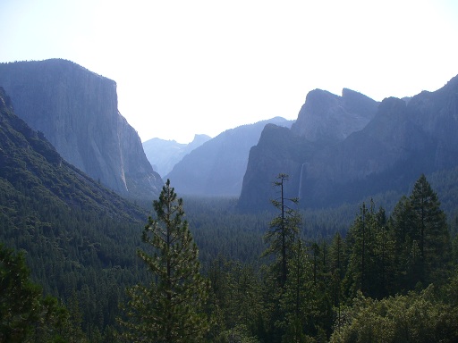
first view of Yosemite Valley from the Eastern end of the tunnel.
~
There is a good view of both the upper (main) and lower Yosemite Falls at a turnout.
 -
- 
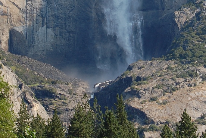
The lower part of the Falls.
~
There is one large parking lot, and little other parking.
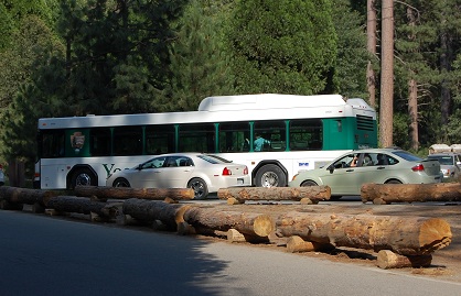
One parks then takes Yosemite Buses (free) to get around.
We had a quick visit to the Visitor Center and the museum there,
Interestingly, Abraham Lincoln set aside some of the area to preserve it
long before parks (including Yellowstone) were created.
also the outdoor exhibit illustrating the lives of the original inhabitants of the Valley.
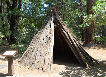
Cedar bark house of the Miwok people who lived in the Yosemite Valley.
These were made of bark from Cedar trees which had been dead for 2 years, making the bark harvesting much easier.
Other exhibits on local food and food preparation were included in the outdoor exhibit.
~ ~ ~
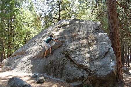
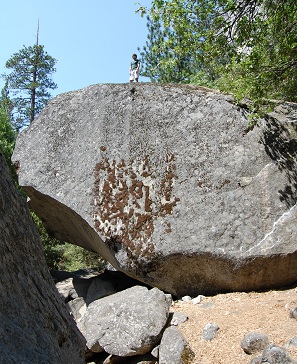
Then we took the bus to Camp 4 which is a campground where the trailhead of the trail up Yosemite Falls is located.
There are some excellent very large bolders available to test your climbing skill.
 - -
- - 
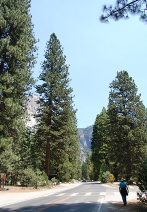
Tall pines
 - -
- - 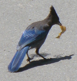
A lizard in Yosemite Valley - - and - - a Jay
We headed back to Curry Village for a sandwich lunch at the local deli,
then took the bus to the Happy Isles visitor center and museum.
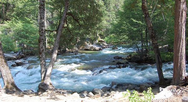
The Merced River near Happy Isles rages at a high level due to a high amount of snow pack melting.
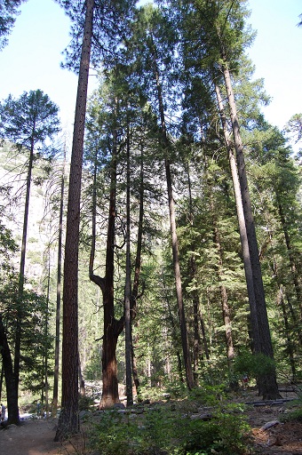 Tall straight pines and
a forked branching Redwood - how things grow differently.
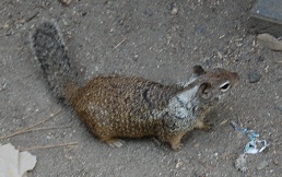
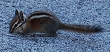
squirrel found at Happy Isles
Then took the bus back to the parking lot and the traffic jam leaving.
Although cars were backed up for hundreds of feet exiting at the end of the day,
there was friendly cooperation and many acts of driver kindness.
~ ~ ~
We stopped at the observation turnout just to the East of the tunnel into the Valley
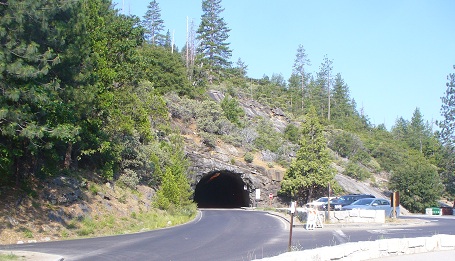
The East side of the tunnel into Yosemite Valley.
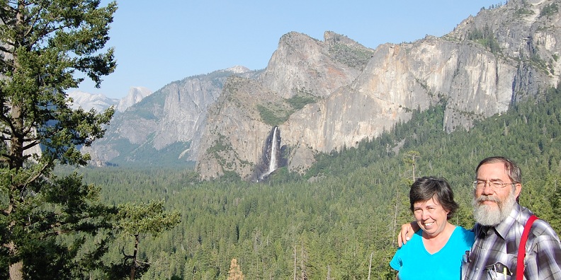
and a fellow tourist shot this picture of Bridal Veil Falls with Mona and Gerard
~ ~ ~
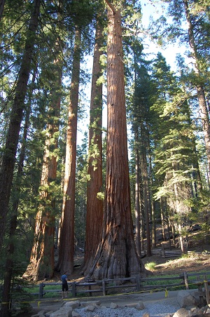
Just before we exited the park we made a proper visit to the Mariposa grove which is just inside the southern entrance to the park.
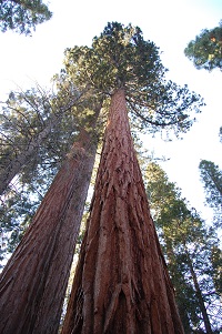
We hiked out to see some truly huge trees - the Sequoia, and other species.
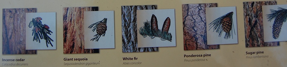
The various trees here - and their cones.
 -
- 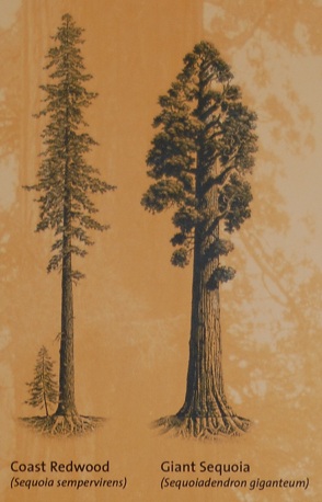
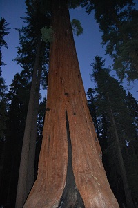
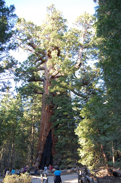
Its really difficult to get a proper picture showing just how tall Sequoias are. - - The Redwood compared to the Sequoia.
Redwood slightly taller, and Sequoia very tall and more massive.
 -
- 
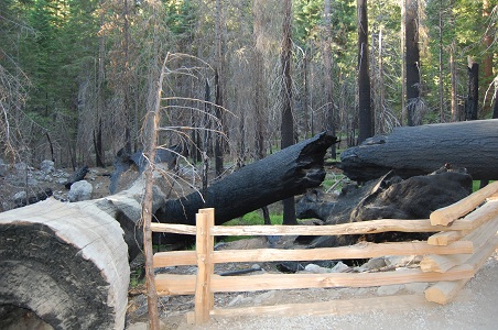
Mariposa fire log is not Sequoia - Redwoods and Sequoia may be damaged by fire but most often are not destroyed.
 -
- 
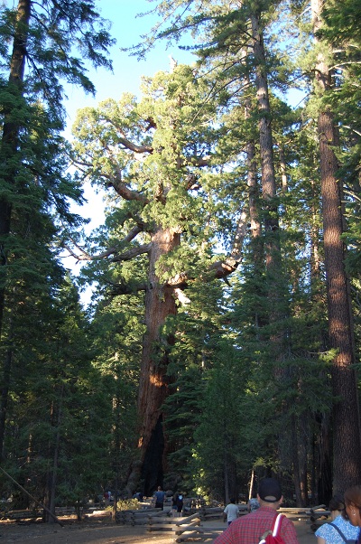
The Grizzly Giant in the Mariposa grove - 209 ft. (63.7 m) tall (taller than the Statue of Liberty in NY Harbor) - 28 ft. (8.5 m) diamater
The branch high up off to the right is 7 feet in diameter.
It has blackened fire scars at its base. It is estimated to be 1800 years old.
 -
- 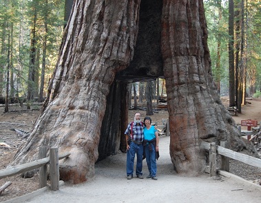
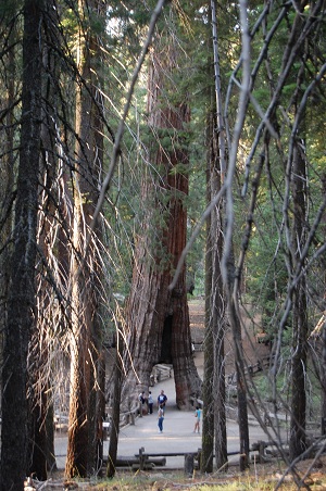
The Mariposa Tunnel Tree - carved out in 1895.
 -
- 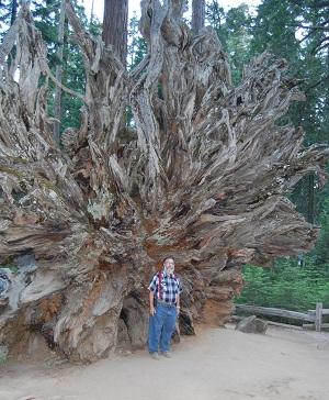
A stand of Sequoias - root structure.
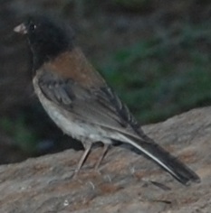
Little bird flitting around as we left the Mariposa grove.
~ ~ ~
We had supper at a Mexican restaurant in Oakville, CA.
Californian Mexican food has a significantly different, and milder tast then our south Texas variety.
~ ~ ~
Back in camp we did laundry until late at night.
Thursday, 28 July
We had a fairly early breakfast,
then headed South driving on Hwy 41 to Fresno,
~ ~ ~
then Hwy 99 through Delano and Bakersfield then joined up with IH 5 and
went over Tejon Pass, which is a good test of tow vehicle power.
We then took IH 210 to Pomona CA and the KOA Fairplex where we set up camp.
-
Pomona - Pasadena - Cal Tech - Los Angeles area CA